Systems Approach to Geomorphic Engineering (SAGE)
The SAGE program increases agency knowledge, skills, and technical abilities to effectively address water resource management challenges to natural hazards that impact public safety. SAGE focuses on identifying current and future needs to better adapt and protect against a range of risks to natural hazards.
SAGE brings together experts and practitioners from federal and state government, national and international organizations, academia, and the private sector to:
- Promote the integration of planning and engineering solutions for coastal resilience.
- Encourage regional, landscape-scale planning.
- Implement actions that consider the use of cost-effective long-term solutions to hazards.
- Improve communication, coordination, and collaboration across jurisdictions.
- Connect practitioners and existing groups working on water resource infrastructure planning and implementation at all levels.
The SAGE program takes a comprehensive view on water resource management with the goal of increasing resilience. The systems approach principle of the SAGE program recognizes that resilience depends on local needs and conditions, and that it is crucial to consider the full spectrum of techniques that can be used and integrated within a watershed. The SAGE program focuses on solutions that maximize both flood risk management and environmental considerations, are informed by natural processes, and protect and enhance community resilience.
Coastal Storm Risk Management Measures for Shoreline Stabilization Brochure
SAGE program partners are collaboratively developing an updated informative brochure that provides an overview of different types of shoreline solutions. *New brochure coming soon*
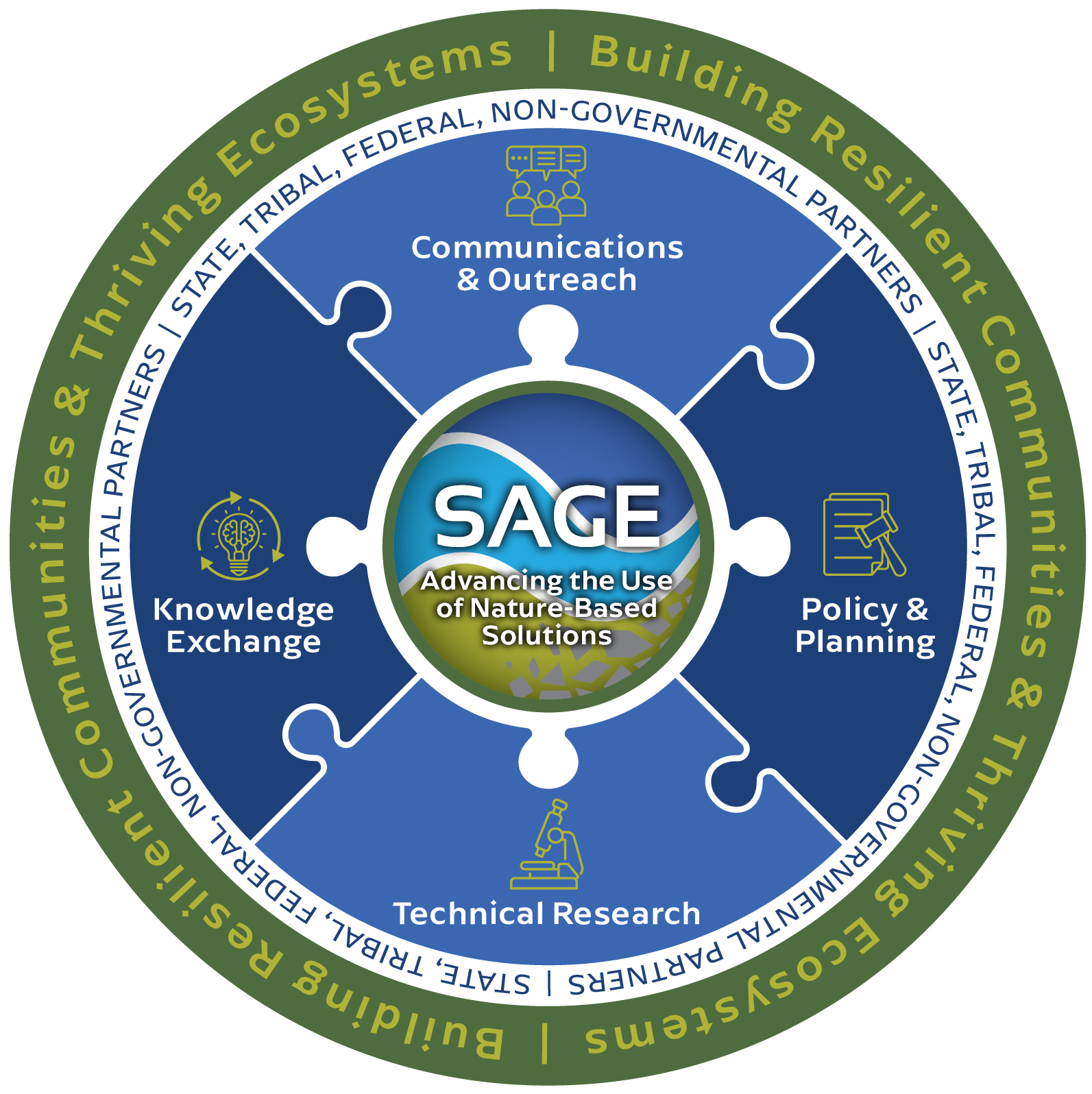
Policy & Planning
SAGE supports planning considerations that better integrate a systems approach for water resource planning within USACE Civil Works projects and beyond. SAGE works to identify cost effective and long-term measures that offer benefits across a range of conditions.
Technical Research
SAGE develops a wide range of technical research focused on the design, performance, risk reduction, and long-term management of planning and engineering solutions across inland and coastal settings. These research efforts help to bridge gaps between policy, planning, and implementation to best determine current and future successes of Civil Works projects. Applications draw from an ever-improving understanding of domestic and international best practices.
Knowledge Exchange
SAGE provides an interdisciplinary multi-agency platform for knowledge exchange to evaluate and implement effective water resource management solutions in the United States and abroad, recognizing the value of connecting practitioners in a shared learning space. Practitioners working on different scales are able to share best practices, cultivate partnerships, and explore innovative ideas that address ongoing and future coastal and inland risks to a range of natural hazards.
Communications & Outreach
SAGE fosters interdisciplinary collaborations across federal and non-federal organizations to promote and accelerate effective water resource management solutions in Civil Works projects. With our regional, national, and international partners, USACE facilitates discussions about lessons learned from previous efforts to design, plan, and implement solutions across a wide range of landscapes. SAGE is also focused on developing educational materials for practitioners and other interests to address water resource risks to natural hazards in their own communities.