Team Activities
Silver Jackets Hub

The Oregon SJ team has identified a top priority to develop an informational HUB that can serve to facilitate community visits, data sharing to communities, and outreach. The State has currently organized the use of HUBs within the IHMT and would like to create a Silver Jackets HUB in it's function as a sub-committee to the state team. Over the past years, an explosion of online information has caused confusion at a community level. This HUB is intended to consolidate these resources for communities.
2020 Wildfire Recovery

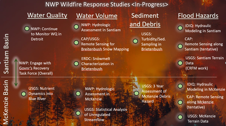
Starting in 2020 the Silver Jackets team developed a partnerships between USGS, DOGAMI, PSU, USACE Portland District, the Cold Regions Research and Engineering Laboratory (CRREL), Civil Air Patrol, and ERDC to monitor Oregon's wildfire impacts. This monitoring ranged from water quality, sediment loads, debris monitoring, and hydrology. This monitoring is summarized as follows:
- USGS and USACE increased water quality monitoring in the affected basins.
- USGS and USACE increased sediment monitoring plan in the Beachie/Lionshead Wildfire including sediment and turbidity monitoring at the inflows to Detroit Lake.
- The Civil Air Patrol, USGS, CRELL, and PSU worked together to use repeated aerial imagery to create a mosaic terrain that was used to map snow accumulation/meltoff in the Breightenbush basin and debris mapping in the McKenzie and North Santiam Corridors. This is a pilot project that tests the approach of using aerial imagery to assess wildfire impacts.
- DOGAMI and USACE are working together to assess landslide susceptibility and model potential sediment runout along the North Santam Corridor. This is a pilot project to evaluate the utility of USACE HEC tools for wildfire modeling.
Luckiamute Flood Study

The floodplain maps along the Benton County reach of the Luckiamute River are currently designated as Approximate Zone A, which is defined as a flood area that was approximately defined without a detailed hydraulic analysis with no Base Flood Elevation (BFE) definition. Thus, with the completion of this study, Benton County will be prepared with the enhanced hydraulic analysis needed for FEMA’s National Flood Insurance Program (NFIP) Zone AE and floodway delineation and subsequently better be able to manage Luckiamute River floodplains.
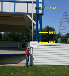
Visualize Flooding with High Water Mark Signs

Several agencies, including Silver Jackets Team partners, worked together to locate and install high water mark signage to increase public awareness in Albany, Turner and Oregon City.